School Trip Area Choices


107171 - Lower KS2 Low Ability [THIS DOCUMENT]
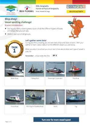
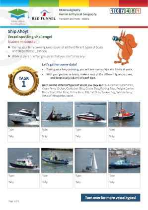
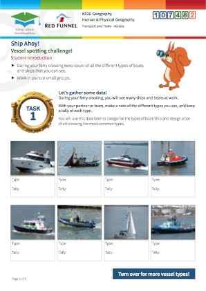
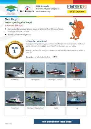
Students will practise identifying different types of vessel and recognising them in a real environment. As a post-visit activity they have the opportunity to develop their geographical and mathematical skills by creating a map showing vessels and their origins, and creating a bar chart representing the different types of vessel.
This is a Human Geography resource focusing on vessels and cargo; it is designed to be used while on board a Red Funnel Vehicle Ferry. The resource engages students with the shipping traffic of the UK’s South- West coastal region from Southampton Harbour via Southampton Water and the Solent to East Cowes on the Isle of Wight. The resource enables students to develop their environmental awareness by observing, identifying and describing traffic in a busy shipping area including identification of types of vessels used for different purposes. There are post-visit options as outlined at the end of this teacher note, designed to reinforce learning and develop understanding of the importance of shipping traffic for trade, industry, leisure & tourism.
Students will learn to use satellite images, compare them to OS map of the same area and will become familiar with key concepts and vocabulary in this context. They have the opportunity to prepare for the trip by watching and discussing the links mentioned above.
Students observe and record, recognise and identify, communicate and co-operate.
Completion of the tally bar chart „ Complete investigation for the bonus activity, including annotating the world map.
Students will demonstrate and develop their understanding of and will acquire knowledge about the close connection of transport and trade. They will demonstrate and develop use of geographical key vocabulary, practise co-operation skills; develop geographical and mathematical presentational skills and the ability to categorise vessels.
Times Viewed
Click to view sample
Full version available to booked clients
Click to download in full